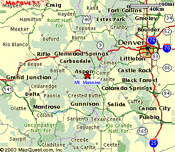
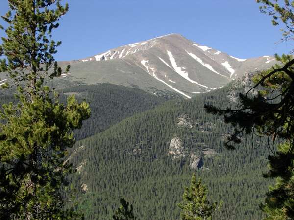
 Mount Massive (14,421 ft), Leadville, Colorado
Mount Massive (14,421 ft), Leadville, Colorado
 |
| Hike Stats | Date: July 2, 2003 | |
| Mount Massive: 14,421 feet | Base: 10,060 feet | Vertical Rise: 4,361 feet |
| Start: 08:00 | Summit: 11:45 | Return: 16:30 |
| RT Dist: ~17 miles | Conditions: sunny and clear | |
It's hard to believe a year's gone by already since my last trip to Colorado. The bitter taste of defeat from my last attempted Triple Banger hasn't fully faded from memory, and here it is already -- another opportunity to add to the list of fourteeners. The circumstances are a bit different this time around for a couple of my friends came along for the ride.
On the week-long tour, we decided on at least one fourteener hike. The lucky recipient of our visit? Mount Massive! The second tallest peak in the state (by 1 foot over Mount Harvard) at 14,421 feet. As we approached the mountain near the historic mining town of Leadville, we see that the mountain is aptly named. It dominates the skyline to the south of Leadville, and casts an impressive shadow over the city. The summit ridge is so long, it seems to go on forever.
I remember Annette telling me of at least two huge blizzards that dumped several feet of the white stuff on Colorado this past winter. So we were justly worried that we might encounter some patches of snow on the hike. The night before, we arrived in Leadville just before sunset, and was able to spy a peek at the eastern slope of Mount Massive where we make our approach. The snow was a little ominous but after studying the topo map in the "Old Testament" (Volume 1 of Dawson's Guide to Colorado's Fourteeners that I borrowed from my friend Scott), we determined that our path is relatively clear. Whew, that takes a load off my mind.
We camped out at Halfmoon Campground, near where the Mount Massive Trail began, during one of the clearest nights I can remember. I don't know if being at 10,000 feet makes the stars appear brighter or I just haven't seen them with such clarity, but we were quite amazed at the display that evening. There was no one else around either, so we pretty much had the campground all to ourselves. We camped in the same site as last year when I hiked Elbert, and I went to bed recalling the circumstances that brought me there almost exactly a year ago...
As is always the case when I go camping, I awoke at daybreak. It was a bit chilly, but not too bad. My new birthday present (an altimeter watch) told me it was 38 degrees, and my skin tended to agree. I dragged out a bag of ramen noodles and cooked it on the camp stove to warm myself and to thaw out my blood. By the time we got packed up and ready to hit the trail, it was almost 8 am.
My friend Russ came along to hike with me, and Andrea decided to stay behind and check out the stream and relax. Russ is a great hiker. I am peeved that he can out-pace me on every hike we go on together, but I'm also glad that he sets a nice pace for me to follow. This would be his first fourteener, so he naturally was psyched up for it. Little did he know that I would soon ruin this inaugural alpine hike for him... Read on!
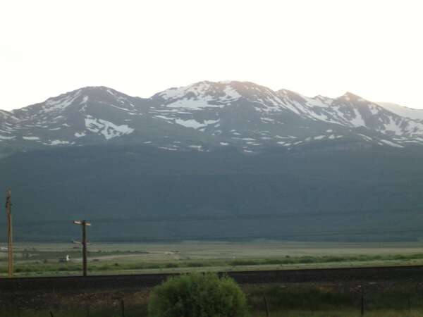
This is a picture of Mount Massive we took the night before as we drove into Leadville from the south. According to the book, our trail approached the summit in the middle of the picture from the saddle to its left. There seems to be a clear path around the left side of the big patch of snow that allows us to get to the summit ridge without getting stuck. Wind usually sweeps the summit ridge clear of snow, so we were good to go for the next morning.
 |
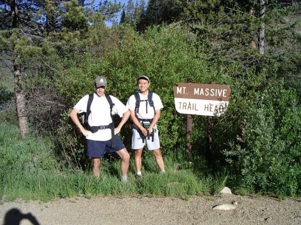
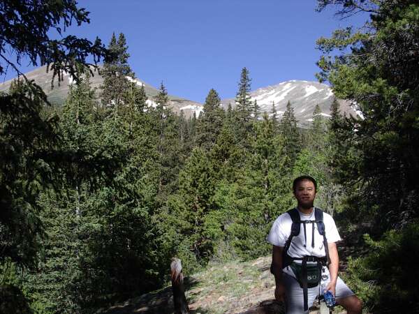
Andrea dropped off Russ and me at the trailhead and took this farewell photo. Russ seems to be doing the flex, while I try to zip up my shorts. Not the best of poses, but I guess it had to be done. The time of the photo was 7:52 am. We're off!
Side note: I'm using my new digital camera on this trip (a Pentax Optio 330GS). One of the side benefits is that I have a timestamp with each photo that I can read later as a reference. Modern technology! Can't beat it.
 |
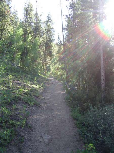
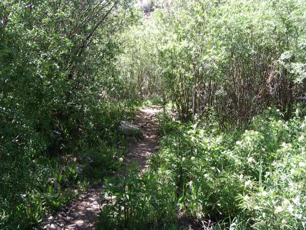
The cool morning burns off as the sun pokes through the trees. This is a nice section of trail as it climbs through patches of quaking aspen and pines.
 |
As the trail climbs higher, we catch a glimpse of the tallest peak in Colorado, Mount Elbert, which is located to the south of Massive.
 |
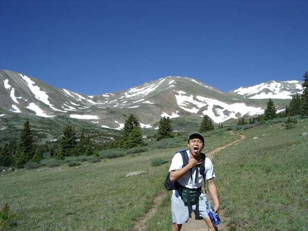
Our first view of the Massive summit. At this point, we are starting to crack "massive" jokes. I think that it's a fine policy to name geographical places with adjectives. You can have infinite fun talking about the "massive" trails, "massive" marmots, and "massive" snow banks. Sure makes the hike a lot more entertaining.
 |
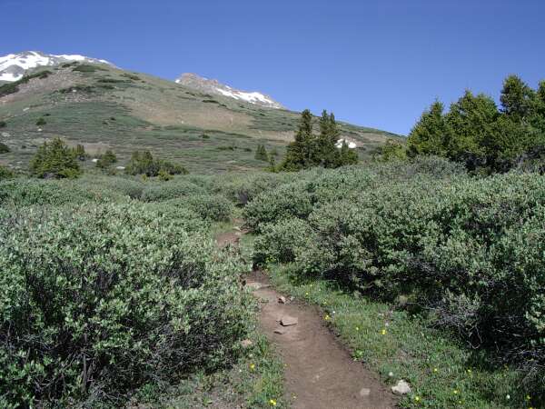
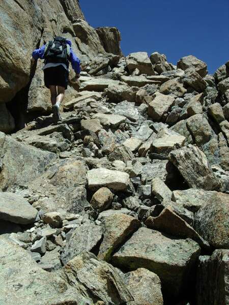
About 1.5 hours into our hike now, and we have broken through tree line. I'm choking from the lack of oxygen, and there's still 2,500 feet of elevation to be gained.
 |
Willows! I hate Willows (bad experience with them at Mount Bierstadt last year). Right about now, Russ starts thinking "we're never gonna get there."
 |
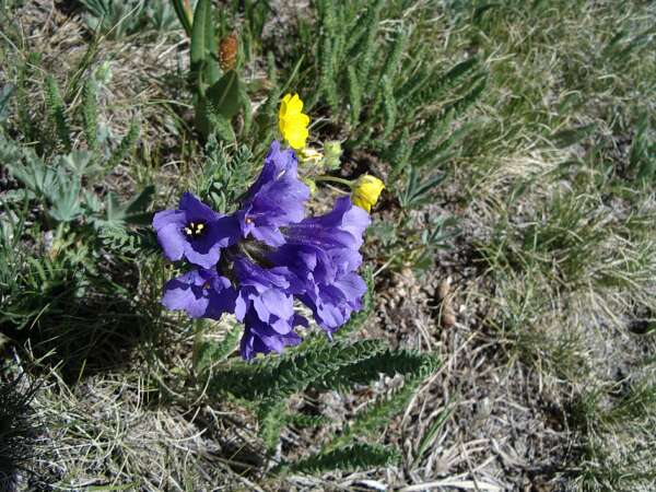
The alpine tundra is a harsh environment, but it can be exceedingly beautiful. This is an awesome wildflower at about 13,000 feet elevation.
 |
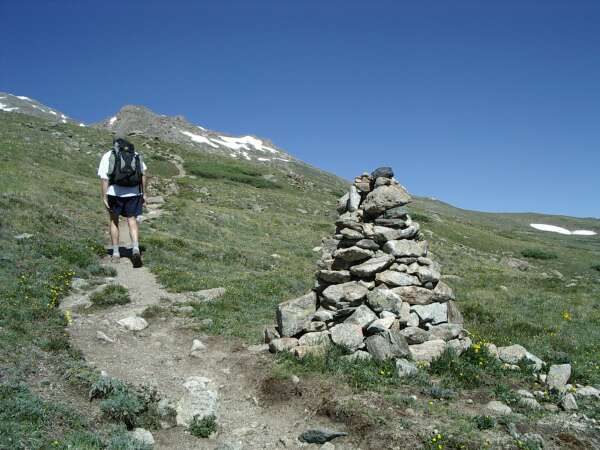
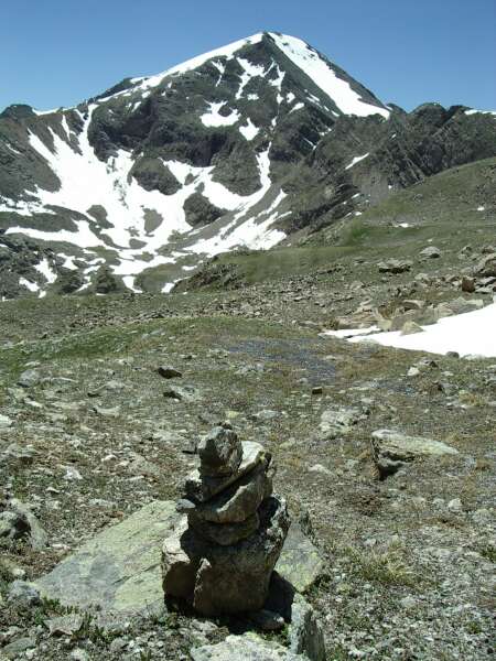
Russ passes a massive Massive cairn. It marks the way for winter mountaineers who can't see the trail otherwise.
 |
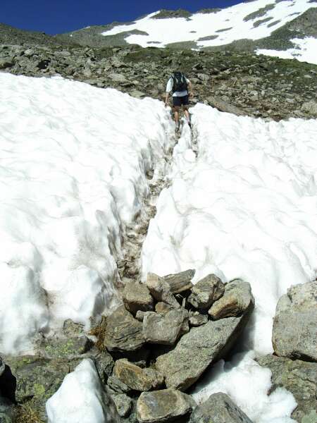
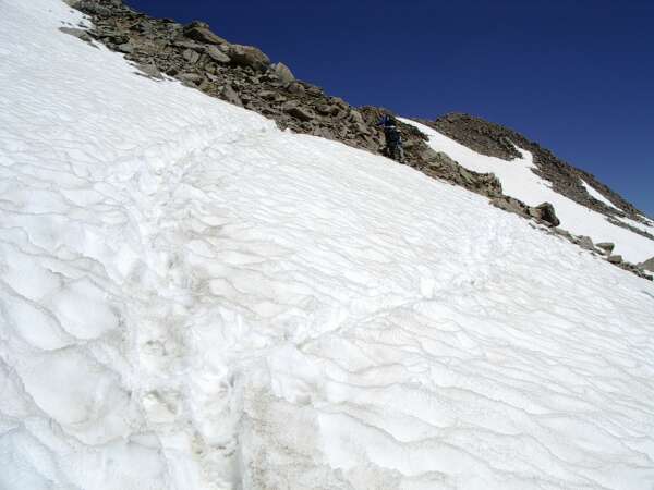
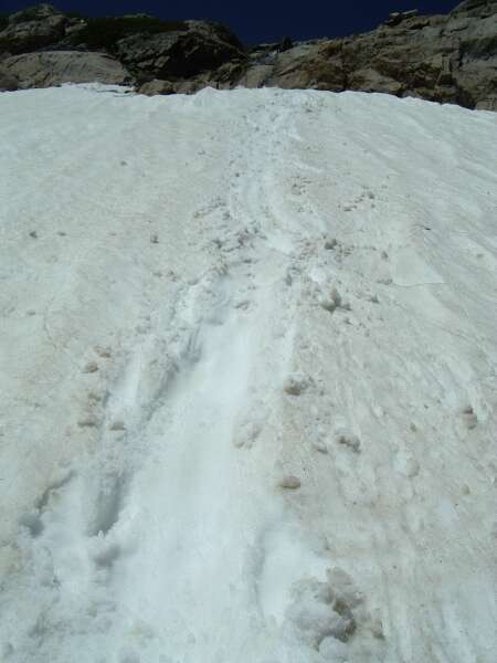
Snow! Fortunately whoever came before us had already worn a path through the knee-deep snowbank.
 |
After many laments of "we're never gonna get there", we finally reach the saddle at about 11 am. The view toward the west opens up in dramatic fashion, showing me snowy peaks as far as the eye can see. The wind kicked up right on cue as we gained the summit ridge. Time to drag out the windbreaker jackets after this photo.
 |
Traversing the east side of the summit ridge, we encounter yet another large patch of snow.
 |
The end is in sight now. Russ goes into his sprint for the top of Massive.
 |
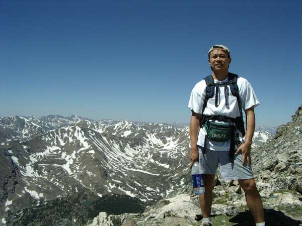
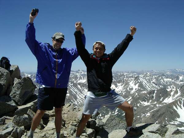
Summit! Mount Massive conquered! Yeay! Russ and I stop for the traditional victory pose. Little did we know that our troubles are just beginning...
 |
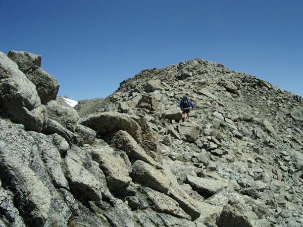
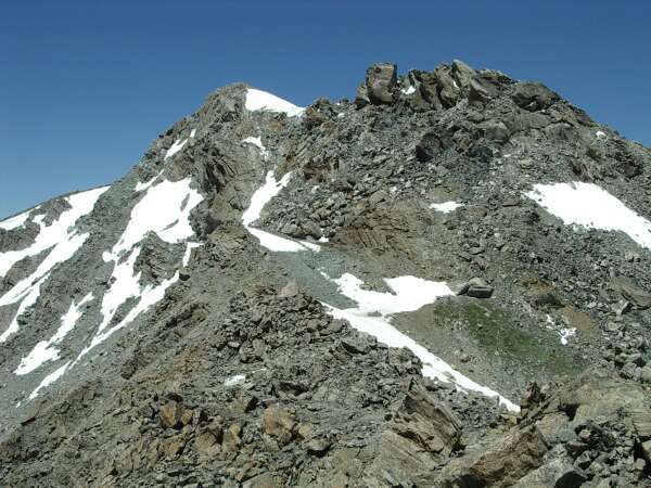
Hey look Russ, there's North Massive, another 14,000+ peak. Let's go over there and tag it too! So this was my first attempt to kill my friend Russ. We traversed (no, scooted across) this 45-degree angled boulder field toward North Massive, slipping and sliding along.
 |
Some trail this is! We are now scrambling up this loose pile of crap, and later ran into a section of exposed unprotected climbing.
 |
Well, this is as far as we got to North Massive. There it is off in the distance. We decide to abort our quest here since it would take another hour or so to get there and back.
 |
So now that we are at the other saddle, let's take the shortcut down the back side of Massive! Thus began our real troubles. Nice going Charles! (This was my blatant second attempt at killing Russ.)
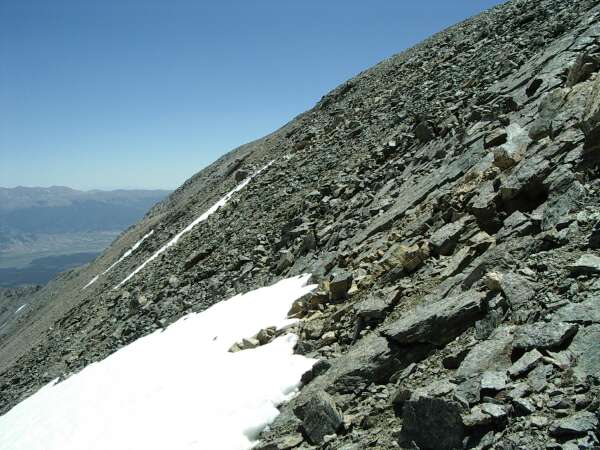
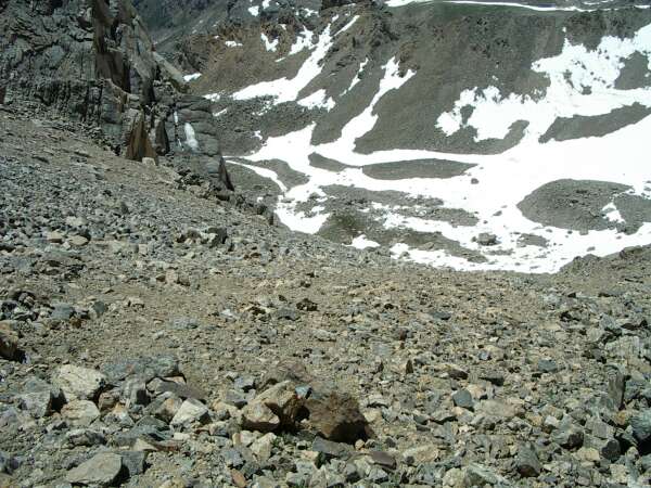
The first part of the other trail (North Halfmoon Creek) is about 2,000 feet of scree. This is looking down from the top at our slippery descent. The camera destroys the perspective here, the angle is about 50 degrees from the horizontal.
 |
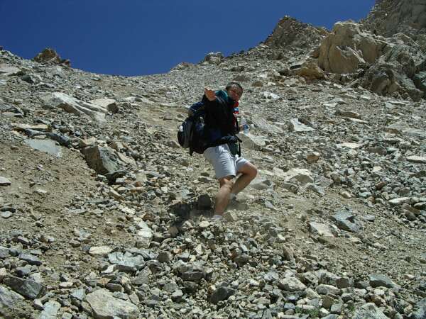
About the only effective way to descend this scree bed is to "surf" it. Here I am showing off the latest moves. If this was film footage you'd see the pile of rocks between my feet and the bottom of the photo move with me. Hang ten folks!
 |
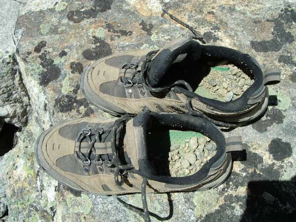
Whew that wiped me out! And look at how much of Massive ended up inside my shoes after that stretch of scree!
 |
With the scree behind us, we're off the hook right? Wrong! We promptly lost the trail. Here we seemed to have reaquired it briefly as I thankfully recorded the cairn on film. But our trail run was short lived since no one (it appears) has been back here all year. We lost the trail again soon after this.
 |
This was the topper of our nightmarish descent on the North Halfmoon Creek Trail. A patch of snow separating us from the trail visible in the distance. After some hesitation, I volunteered to try to scoot down the snowy slope. As you can see by the skid marks, my traction didn't hold out. Screaming obscenities all the way down, I slid on my butt down this hill. My hands were almost frostbitten after being used as brakes, but we made it down and definitely found the trail. It is now about 3 pm, the time we told Andrea we'd be back at the car. And we haven't even reached tree line yet! Oops.
 |
The trail is quite clear now, and we have nothing to worry about anymore. It's just a mad dash for the car. Along the way, we see this lush oasis above tree line.
 |
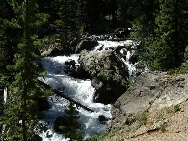
All that snow melting into trickles, combined into streams, and formed into a raging river.
 |
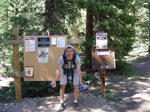
At 3:40 pm, we reached the other trailhead. I am pooped out from all that hard work. Scree, snow, racing down the mountain took its toll.
We were hoping to see Andrea at this trailhead since I left her a voicemail message, but no such luck. Some rangers agreed to go find Andrea and bring her back to get us (they couldn't legally give us a ride). We decided to hoof it back toward our orginal starting point in case they couldn't find her.
 |
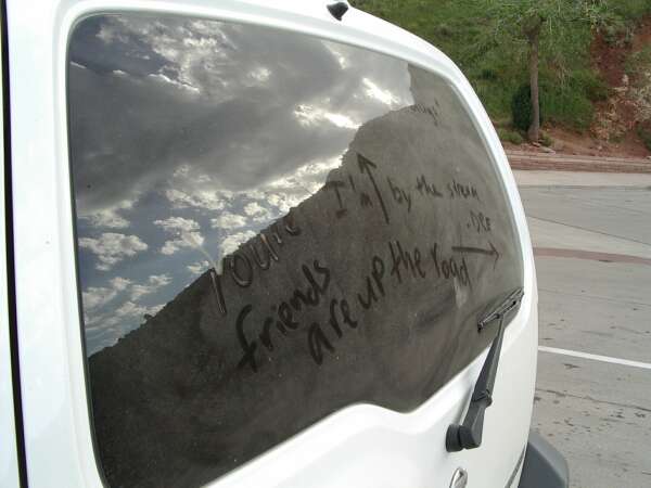
45 minutes and 3 more miles on level ground later, we finally reached the other trailhead. Andrea pulls up just as we walked into the parking lot. Great timing! We are saved. We see the message the rangers left for her on the back of the car. Apparently that's an effective way to communicate in Colorado as we saw another vehicle with this type of insignia.
Well, it would have been a piece of cake had we just gone up and down the same trail. But my greed to reach North Massive really made things quite a bit more complicated and cost us several hours of wandering around in the wilderness. Sorry Russ!
 |
| Prev | Next | Index |